
In 1878, the low ground just south of the Continental Mill, along the Androscoggin River in Lewiston, was a pasture. Thirteen years later, more than a thousand French Canadians lived on it.
The Lewiston Saturday Journal called it “a building boom that discounts the West.” The people who lived there called it the Island, or Little Canada.
You don’t have to take the newspaper’s word for it. The maps show it happening, and Lewiston happens to have some of the best old maps in Maine. Let’s walk through them.
1858: A canal, a mill and almost nothing else
Start with the falls, because everything in Lewiston starts with the falls. This engraving ran on the border of an 1858 map of Androscoggin County.

Around 1850, Massachusetts investors set out to turn that drop in the river into power. Irish laborers, many brought up from Boston, dug a canal to carry water from above the falls to a row of new cotton mills.
Here’s what the result looked like in 1858. The map was surveyed by J.Q. Page and published by J. Chace Jr., and it includes an inset of Lewiston and Auburn.

Now zoom in on the canal. The Bates and Hill corporations line it. West of the mills, Oxford and Lincoln streets are laid out, but only a scattering of buildings stand on them.
At the bottom, near the river, sits a lone building marked “Porter Mill.” Keep an eye on that spot.

Who lived by the canal first?
Not the French Canadians. The first families here were the Irish who dug the canals. In 1891, a Lewiston Saturday Journal writer remembered their settlement, right where the Continental Mill would later rise:
“Fresh from the ‘old sod’ they established a ‘patch’ where the Continental Mill now stands, and a hundred or so little houses of but one story, banked to the eaves with sods, with but one or two small windows and a door, usually, furnished a shelter for the occupants.”
That Porter Mill on the 1858 map was built that same year. In 1866, the Continental company bought it and built it out into a much bigger complex.
By 1882, Varney’s Gazetteer of the State of Maine called the Continental the largest cotton mill in Lewiston. It ran 70,000 spindles and employed about 1,200 people.
1875: The bird’s-eye view
Fast-forward 17 years. In 1875, publisher J.J. Stoner of Madison, Wisconsin issued this stunning bird’s-eye view of Lewiston and Auburn, printed by Shober & Co. of Chicago.

You could get lost in this one. The mills stand shoulder to shoulder along the canals, smokestacks and all.

Down by the river, the map’s legend marks the Continental Mills as number 22 and the Lewiston Mills as number 26. Look just south of them, below Cedar Street. It’s mostly open ground, with a few paths and scattered houses.

That empty ground is about to fill up.
“From a Pasture to a Populace in Eight Years”
On October 24th, 1891, the Lewiston Saturday Journal ran a long feature on the neighborhood. Check out the headlines.

The writer explained just how fast it happened:
“Eight years ago, a barren tongue of land of half a dozen acres or so, near the Lewiston gas-house, the mill outlets, and stretching out into the smiling river. To-day peopled with from 1,200 to 2,000 people, according to how you estimate, with almost 200 tenement houses and half a dozen now in process of building.”
So why “the Island”? The paper had an answer for that too. When the Porter Mill was built, its builders needed somewhere to send water from the mills above:
“‘The Island,’ so-called, derived that name from the fact that, in building the old Porter Mill, now the Continental, a temporary outlet was required for the water from the mills on the upper level, and the course of the water was deflected that way. At first it was but a small surface stream, but it soon gullied the earth away and became about as deep and wide as an ordinary canal.”
According to the Journal, the land was still a pasture in 1878. In 1879, John Delouche and a Mr. Mainville built houses there. They were the first French Canadians to own homes in Little Canada. More families followed nearly every year after that.
“Three years ago there were no streets on the island, and now there are one hundred and eighty-four tenements! And yet they talk of Western booms.”
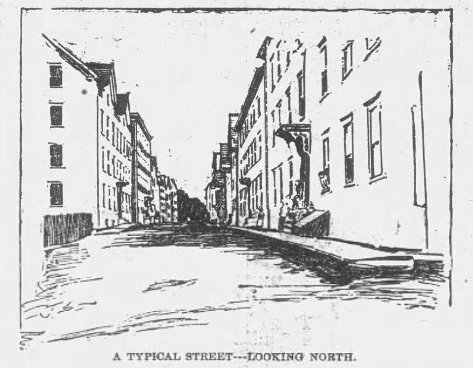
The paper even sent an artist. Here’s “a typical street,” looking north.
And here’s the back of one building, stacked with porches. The paper called it an eight-tenement back area.

Most of the newcomers, the writer said, came from below Quebec City on the St. Lawrence, and many had been farmers. One woman of 80 told the reporter she’d been asking Jean to send her back to “the little village in the North to die.”
What the fire insurance maps show
This is where it gets really fun. The Sanborn Map Company drew Lewiston building by building for fire insurers. The Library of Congress has the 1886, 1897 and 1914 editions online, and they let you watch the neighborhood grow.
Here’s the 1886 key sheet. Little Canada sits on the left, just below Cedar Street and the Continental Mills, along the river.

By April 1897, the land below Cedar Street is packed. Notice the tenements crowding Oxford Street and a new lane called Fox Street.

Lewiston’s 1995 downtown preservation plan read these same maps. It says Oxford Street was extended south of Cedar in 1886, and that by 1897 Little Canada “would come into existence.”
Something doesn’t line up there. The Journal was already calling the place Little Canada in 1891, with 184 tenements and more than a thousand residents. And look back at the November 1886 Sanborn: tenements already stand on both sides of Oxford Street below Cedar.
One block, three maps
Now our favorite part. Here’s the same block, between Chestnut and Cedar streets, on all three maps.

In 1886, three big brick boarding houses belonging to the Continental Mills line Oxford Street. Across the alley, Lincoln Street is mostly small shops, with tenements tucked between them: groceries, candy, drugs, an oyster house. At the top right corner is the Dominican Block, built around 1882 as the parish school.
By 1897, the boarding houses have become “tenements.” The shops have filled in.
In 1914, the southern boarding block is gone. St. Mary’s rectory and St. Mary’s French Catholic Church now fill its site, the church colored blue for stone. The map notes a “flat roof” and just 8 feet to the eaves.
That’s a church still being built. Lewiston’s walking tour dates its construction from 1908 to 1928.
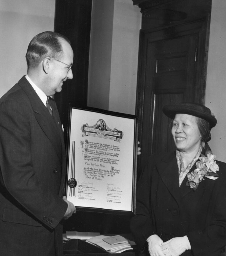
French-Canadian workers also appear in Jack Delano’s photographs of Aroostook’s 1940 potato harvest. For another immigrant family’s working life, there is Toy Len Goon and the laundry she ran in Portland.
Little Canada today
The two northern boarding blocks are still on Oxford Street. They’re listed on the National Register of Historic Places as the Continental Mill Housing, built in 1866 by Amos D. Lockwood and Albert H. Kelsey. They’re the last of the mill blocks that once lined the street.

St. Mary’s held its last Mass on June 25th, 2000. The Diocese of Portland then sold the church to a community group for $1. Today it’s the Franco Center, a performance hall and cultural center.
The neighborhood itself has thinned. The 1995 preservation plan counted 46 tenements on the 1956 Sanborn map, and 16 of them had since been torn down. Almost all of the west side of River Street was gone.
And the Continental Mill? Its 1858 Picker House, part of the original Porter Mill, is now the 72-unit Picker House Lofts. As of 2024, a developer planned hundreds more apartments in the rest of the complex.
So the next time you cross the bridge from Auburn on Cedar Street, look to your right. That’s the Island.
Lost Maine stories, in your inbox.
The newest story, plus a few from the archive.
Free. Unsubscribe anytime.
We use AI to help research, write and edit stories across our sites. Here’s how we use AI.Suggest a correction